
 |
| Western face of Les Monges |
Les Monges (2,115 meters) attracts walkers from all directions, and the best walk for the top of Les
Monges is in my opinion still the walk published on this blog 03.07.2013,
called the ultimate Crete walk (from Authon). The main attraction with that
walk is that you stay up on the Crete for most of the day and up/down the Crete
is quite strait forward.
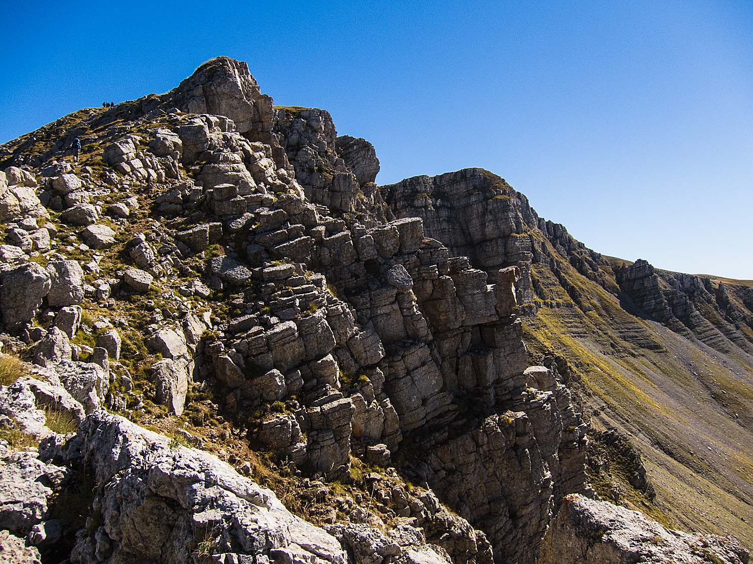
This walk explores the
northern ridges and slopes of Les Monges and have the advantage of visiting the
lovely Lac des Monges on the way down. It’s quite a long walk if you include the top of les Monges. The GPX-file does not include the last 1.5km to the top (200m up) and you would have to add a good hour if you decide to do this.
To shorten the walk on the way up, you could do a short cut from the La Sapie Ruins in south east direction, taking the small path directly for the Ridge at around the 1743 meter point (see map).
To shorten the walk on the way up, you could do a short cut from the La Sapie Ruins in south east direction, taking the small path directly for the Ridge at around the 1743 meter point (see map).
 |
| Northern ridge and Les Monges in the background |
You take the No 23 Exit
(Sisteron North) from the A51 Motorway and follow for La Motte-du-Caire. You
soon get on the D951 road (still for La Motte), but make sure you get off this
road only 4 km before La Motte. You turn right onto D1 for Clamensane and 3.5km
after passing through Clamensane, you take the small D751 road for Reynier. It
takes about 10 minutes up to Reynier, but you need to drive on another 10
minutes to Baudinard, a total of about 1.5 hours’ drive from Pertuis. If you
have problems parking at Baudinard, turn back and park at the “bottom” where
the road did a 360 degrees turn at the 1057 meter point (see map).

The walk starts going
straight south from Baudinard on a red marked trail for La Sapie and Le Crete,
and after about 20 minutes you see the farm situated on a large slope of
fields. You turn sharp right off the road a few hundred meters before the farm
house and follow the red markings out of the fields and into the sloping
woodland. It takes about another 45 minutes to the La Sapie ruins, where the
red path takes right and follows an easterly direction. The red markings
becomes more scattered and old, but you just follow the path and the map. After
some 30 minutes, you are just below the La Sapie Col at 1744 meters, and here
the path turns left upwards for the top of the mountain ridge, which you reach
in less than 10 minutes.
 |
| Les Monges: The top. |
Now you have a fantastic
360 degrees view, which you will have with you for another 2 hours plus your
lunch time. You see all the neighbouring mountains close by and a large range of the Alpes in the north. When
you get to about the 1743 meter point on the Ridge, you see a path coming up
gradually joining the Crete around here. This is the short cut one can take to
reach the Ridge a good 30 minutes faster going directly from the La Sapie
Ruins.
After 1 hours walk along
the ridge from the 1743 meters point, you get to Crete du Rause at 1915 meters,
where there is a large signpost. Here you could decide to drop the 60 minutes
up to the top (and back). You have about 2.5 effective hours walk back to
Baudinard via Lac des Monges. But if you have time to walk up to the top, you
will be well rewarded with strange mountains and rock formations, and large
green areas, some in shelter from the wind.
 |
| Lac de Monges |
The walk down from the
mountain takes incredible long because of the way the path has been
constructed, but it’s a very nice walk and very easy going for a path that
could have been much steeper. You see the lake on your left after about 1h 20
minutes. You should take a short rest here on the western end of the lake
before starting the last “lap” of the walk, which could be quite steep in
places. No real problems, however; the path are also meant for horses, though I
doubt you will meet any. You see the yellow signpost for Baudinard at the
western end of the lake going straight down the mountain side, passing a
natural “source” after a short time. You should recon on a good hour down to
Baudinard, unless you have a very steady foot going downhill.
Basic information:
Duration: 7.5h (including total of 1h stops, which
might not suffice)
Distance: 16 km.
Ascent: 900 m (accumulated)
Difficulty: Moderate (but a long hard walk unless
using short-cuts)
Start/finish: Baudinard (see driving instructions from
Motorway)
Map: IGN 3339 ET
VisoRando Lien.
Pour le fichier GPX,
vous pouvez télécharger à partir d'ici (voir ci-dessus) ou mettre à jour via ce
lien VisoRando où vous pourrez également voir l'itinéraire sur une bonne carte:
For the GPX-file, you
could download from here (see just above) or go to this VisoRando link where
you also will see the route on a good
map.
If
you have problems with this VisoRando link, download the GPX-file from above
and import it to VisoRando or other application.
 |
| Some of the views of the Alpes. |
 |
| View of the Alpes from the top of Les Monges |
No comments:
Post a Comment